History
In 1756 the Commissioners of Inland Navigation for Ireland began work on the Lagan Navigation. Thomas Omer was appointed engineer in charge. In constructing the navigation, Omer opted to improve the existing river channel where suitable and to create a new ‘cut’ or canal levitra where the natural water course followed large loops or meanders. Within a year a navigable channel existed from Belfast to Drum Bridge and by September 1763 this extended to Lisburn. The official opening took place among scenes of great enthusiasm and the first lighter to make the voyage was the ‘Lord Hertford’ carrying 45 tons of coal and timber.
Traffic on the canal increased throughout the 19th century but, eventually, competition from first rail then mechanised road transport caused a serious reduction in use. This understandable change was made more severe by the effects of the First and Second World Wars. After 1947 there was no canal traffic above Lisburn. The Lagan Navigation Company was dissolved in 1954 and the canal, between the Union Locks and Lough Neagh, was officially abandoned for all navigational purposes. The Lisburn to Stranmillis section remained open for a short time longer — It was closed in 1958. Control of the Navigation passed to the Government which, through the Department of Agriculture, carries out such works as are necessary for drainage, flood prevention and public safety. Today, the Ml motorway, between Sprucefield and Moira, runs along the route of the old Lagan Canal.
Relics of the Canal
There were eighteen locks from the start of the Navigation at Stranmillis to the summit level at Sprucefield. Each lock, or group of locks, required a lock-keeper, and he was provided with a house nearby. Many lock-houses were demolished when the canal closed but a few examples still survive at Drum Bridge (restored), Ballyskeagh Bridge (derelict) and Hilden Bridge (much altered).
Most of the locks have been wholly or partially removed. However, some are still recognisable, in varying degrees, at Stranmillis, Newforge (where there is still a typical, small hump-backed bridge), Ballydrain, Drum Bridge and the Union Lacks. At several of these, the bollards to which the barges were tied up are still in position, while at Drum Bridge iron sheaves or pulleys may be seen on the parapets. The pulley controlled the tow rope as the barge was drawn under the bridge.
How the Canal was worked
Most canals were built before the development of mechanical propulsion. The only methods were therefore human or animal power, or the wind. Sailing vessels were once common on some rivers and canals in Great Britain, but on the Lagan the principal method of traction was almost exclusively the horse — in later years some motor lighters were in use.
Each barge or lighter required a crew of at least two men — one to lead the horse and one to steer the barge. It seems remarkable that a single horse could pull, even if only at walking pace, a laden barge weighing up to 85 tons. Such was the ease of water transport. The horse could not, of course, walk directly in front of the barge as it would in front of a cart. Rather, the barge was steered to remain in mid-stream while the horse, walking along a path by the side of the canal, pulled the barge by a long tow rope. The path was known as the towing path, or towpath for short. And so it remains today, even though the barge horses completed the long haul many years ago.
The Towpath Since 1958
The condition of the towpath deteriorated rapidly after the canal closed, although certain lengths remained popular as walks. When the Lagan Valley Regional Park was set up, in the early 1967, restoration of the towpath was actively encouraged.
Locks of the Lagan Navigation
A total of 13 locks are located along the 16kms of the Lagan Navigation between Belfast and Union Locks, Lisburn.
Lock 1, is known as Molly Ward’s, after the 18th century tavern. It was run by Molly and her husband William, a lock-keeper. It is a general misconception that the cottage on Hay Island close to the lock was “Molly Ward’s” tavern a meeting place for United Irishmen involved in the 1798 rebellion. The actual site of Molly Ward’s was a quarter mile upstream and regrettably no trace exists.
Lock 2, known as Mickey Taylors’ after one of the lock-keepers. Here the canal splits from the river and a small bridge adjacent to the lock links the towpath to the island, the lock keepers path and Moreland’s Meadows.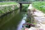
Lock 3, is known as Mc Leave’s Lock. One of the few places on the Lagan canal where the lock, the lock-keeper’s house and stone bridge all remain intact.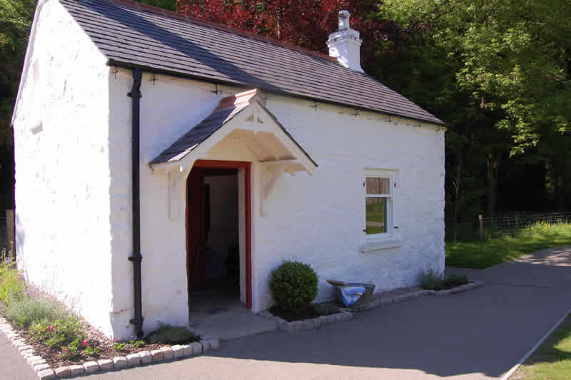

Lock 4. The canal once again splits from the river forming an island. A footbridge leads to the picnic site where the Lagan races over Eel Weir.
Lock 5. The peaceful stretch of canal between the fourth and fifth locks provide important wetland habitat for birds. In early spring and summer mute swan, dabchick, ducks and moorhen nest along the canal.
Lock 6, known as The Drum. Drumbridge, a three arched stone bridge dating to the early 19th century. Relics of the navigation are evident at the sixth lock where tie up bollards to secure the barges still remain. One of the original lock houses can be seen from the bridge in the grounds of Sir Thomas and Lady Dixon Park. Drum Bridge car park offers another access point to the towpath via a short riverside path. Across the road from the car park is St. Patrick's Church framed behind a topiary archway. The first record of a church on the site is 1306.
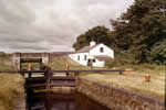
Lock 7, known as McQuiston’s, still has the original arch bridge. Though the lock house lies in ruins, its sandstone remains can be seen by crossing the small stone bridge. Here the motorway blocks the old canal system but the towpath continues underneath it through an underpass.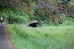
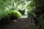
Lock 8. Continuing in a south-westerly direction the towpath passes the Seymour Hill Housing Estate above the river on the right, which can be accessed by the green footbridge, known as the Rambler’s Bridge. To the left there are two access points from McIllory Park, one at the bridge, the other just past the eighth lock and island footbridge. Ballyskeagh High Bridge is a rather majestic sandstone bridge. The steps beside it lead to the road above and another of the lock houses that still remain, giving a rare glimpse of the architectural style of Thomas Omer, Lagan Navigation’s engineer in charge.
Lock 9. The large buildings of the Coca Cola bottling plant, adjacent to the lock, dominate the edge of the towpath where it meets Tullynacross Road. The Lambeg Bleach Works formerly occupied this site. Both chose the location because of the deep underground aquifer that supplies large amounts of clean fresh water. A bleach green was first established here between the river and canal in 1626.
Lock 10. At Hilden the towpath approaches the tenth lock and crosses the road next to an old bridge. Just beyond the bridge is the site of one of the last working mills. It was originally known as Hilden Mill and was one of the largest in the area. Further upstream the mill quay can be seen, with the tie up rings for the barges still in place.
Lock 11. Following a bend in the river the towpath passes the eleventh lock, known locally as Scott’s Lock. At this point three water courses run parallel with each other, the river, the canal and the mill race. The water from the mill race was used to power the machinery in the mill and factory. The towpath continues between two housing estates, Millbrook, and Hillhall, where waterfowl add life and colour to the river.
Lock 12, known as Hanna’s lock, was restored as part of the Lagan Valley Island project. The towpath originally followed Canal Street to Union Bridge. However the path now veers northeast of the Island Civic Centre and on to a system of pedestrian crossings to rejoin the towpath on the other side of Union Bridge.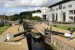
Lock 13. From here the lock, the weir and the sluice gate for the mill race were managed by the lock-keeper. It is often referred to as Becky Hogg’s after the lady who worked the lock. The path that the mill race took is still evident in places between Hogg’s weir and Lisburn, adjacent to the towpath.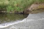
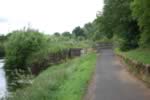
Locks 14 - 17. The Union Locks marked the hub of the Belfast-Lough Neagh canal system and remains a site of considerable industrial archaeological interest.
The Union Locks comprised the only multiple lock system on the canal, with an impressive flight of four locks, divided into 2 sections by a pond to allow boats to pass. The Union Locks were constructed to lift the canal 26 feet 4 inches from the River Lagan to the summit level of the canal system within a distance of less than 100 yards. The canal was opened from Lisburn to Lough Neagh on 1 January 1794, though work at the Union Locks continued until May 1796.
The volume of traffic on the canal declined rapidly in the 1930s and after 1947 there was no traffic between Union Locks and Lough Neagh.
Most of the canal between Lisburn and Lough Neagh was subsequently destroyed when it was used to form the foundations of part of the M1 motorway, which commenced in the area in November 1961. Although the river flows on, the canal channel has been built on and now lies beneath the motorway. It re-appears near Moira to continue towards its final destination at Ellis’ Gut, Lough Neagh.


