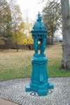
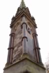
Lester's Dam
Named after a man called John Lester who once leased the neighbouring land, Lester's dam provided Belfast's first piped water. Nearly 200 hundred years ago, the dam was built to hold back a reservoir of one acre capable of holding 1,000,000 gallons. Nearby there was a small pump house with a modest set of engines. The brick ruins of this building, and the remains of the dam, are visible today, and the spring still flows.
The water was conveyed to Belfast by gravity in an open aqueduct, which followed the line of the river until it reached two small holding ponds at Mount Pleasant and then it was piped down to Cromac and Fountain Lane. In 1840 the newly formed Belfast Water Commissioners took over responsibility of Lester`s Dam, and the water scheme from the Charitable Society, who had helped establish it. Now, two centries later, the spring is again being tapped, by the Water Service, to supplement Belfast`s water supply.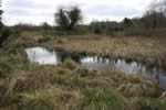
Belvoir Motte
In 1177 John de Courcy led an army of Anglo- Norman knights and soldiers from Dublin. After a victory in Downpatrick, he took over a large part of counties Down and Antrim.
In order to secure this land he built two stone fortresses in Carrickfergus and Dundrum. He gave land to his knights to reward them for their military service and they erected 'motte and bailey' castles from earth and timber to defend their lands.
Belvoir was one of these private mottes. 'Motte' is a French word meaning 'mound'. They were man-made and were constructed by digging earth up from a ditch and then covering it with a layer of clay to stop erosion and slippage. At Belvoir the motte rises on the highest point of the river bank, with the bailey to its North East at a lower slope of the bank. The bailey has been largely displaced, first by the construction of a carriage way, that extends between it and the motte and then by the erection of the ice house. From the top of the motte in Belvoir you can see how they would have been able to defend it from people attacking from the river which would have been one of the main means of access at that point.
On top of the motte there would have been a wooden castle or 'keep' which would have housed the knight and his family. The bailey was the area where the ordinary people and all the animals would have lived. It would have been connected to the motte by a wooden bridge or causeway and in times of attack everyone would have retreated into the keep for safety.
The lord could over look the River Lagan and most of his land which would have included most of Belvoir Forest. John de Courcy was based in Carrickfergus so all his knights would have travelled there for important occasions.
Norman power declined in the 14th and 15th centuries especially after the invasion of Robert the Bruce between 1315 and 1318. Gradually castles like the one at Belvoir were abandoned.
The Burma Road
The Burma Road is the raised path from Newforge to Shaw's Bridge. It was built from old Nissan huts, Anderson shelters and rubble from World War II.
Early Christian Ring Fort - Clement Wilson Park
This 'rath' or 'fort' is typical of an early Christian fortified farm and there are many throughout Ireland. St Patrick came to Ireland about 432 AD and along with a number of other people brought Christianity to Ireland. These forts date back to that time and beyond so many of them would be approximately 1500 years old. The forts were really farms and were usually built on raised land as in this case. The raised mound where the trees are would have contained houses for humans and animals.
In many cases they are located close to sources of food and water which was obviously very important. Rivers and the sea were both sources of food and communication because travel by water was much easier than travel by land. In this case the River Lagan would have provided a good source of food. The farmers usually had small fields outside the fort where they grew crops. They had several different varieties of grain and they also grew peas, beans, onions and celery and kept animals including cattle, horses, pigs, sheep, hens and bees. Geese and dogs were kept as well and both of these proved to be very useful for guarding the property. The cattle herds were the most important mainly because they were a source of milk which was a very important part of the diet.
The forts were built mainly to keep the animals safe but also to help defend the families themselves from other people.
There was a ditch built around the fort. It was mainly to keep the animals from escaping and to protect them from cattle raiders. It was also there to stop wild animals from coming in. In those days there were still a lot of wolves around.
It would not have been a very strong defence against raiders because they could have easily climbed the banks.
As it was being dug out the soil was piled up on the bank to make it even steeper. Sometimes they built a fence round the top of the bank as well. The cattle would have been let out during the day and brought in at night. They had small leaf-shaped fields.
These forts were lived in from approximately 500 AD until about 1200 AD.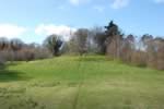
Giant's Ring
Though it is close to Belfast, the Giant's Ring lies in open countryside, on a plateau in a bend in the River Lagan. The Giant's Ring is the type of enclosure called a 'henge monument.' The first people migrated to Ireland about 7,000 BC with a second wave about 2000 BC. The resulting mix of cultures led to changes in megalithic (large stone) tomb construction. The Giant's Ring is believed to date from this time which would make it late Neolithic (New Stone Age) or early Bronze Age. It was the centre of a ring of tombs which formed a large prehistoric ceremonial site. The monument in the centre is a 'passage grave' whose stones have collapsed and the earth covering it has been stripped away. 'Passage grave' just means that there was an entrance way which led you towards the main central area. The orientation of the passage grave was believed to be important and was determined by the direction of sunlight in the summer solstice.
Excavations of the site have also revealed three rings of timber posts and cremation pits.
The stone wall round the outer base of the bank was built in 1841 to protect the monument. An inscription facing the car-park commemorates its building by Lord Dungannon who earnestly recommends it [the ring] to the care of his successors.
The Historic Environment Division are guardians of the site. The land is privately owned and farmed - the soil is particularly good for arable farming - but when the monument was originally built the land was most likely set aside for ceremonial purposes.
Lisburn Castle Gardens
Lord Conway's castle was built on this site in 1622 but was destroyed by fire in 1707. The castle was roughly E-shaped with three projecting wings. Lisburn was almost destroyed in the rebellion of 1641 but the town and castle were rebuilt in the 1650s. It was during this time that the gardens were developed by a Dutch gardener who was brought over specially. His influence was seen in the terraces, stone walls and pots of colourful flowers which give this area its distinctive look.
In 1707 an accidental fire destroyed most of Lisburn including the castle which was never rebuilt. The gardens were given over to the townspeople for recreation.
The grounds and gardens have been altered over time and still remain open today for the pleasure of the public.